Managing Mason Gulch
The City of Tacoma and Metro Parks are working on a natural resource management plan for Mason Gulch, and they're looking for public feedback on what that should entail. If you're not familiar with Mason Gulch by name, you may know at least its outer edges by sight.
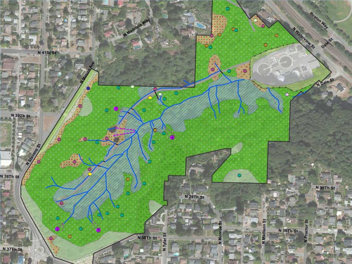
The 36-acre gulch runs from the top along at North 37th and Stevens/Mason (that open area near the roundabout); down to Waterview Street, a short hop under the train tracks to the Ruston Way waterfront, roughly between Duke's Chowder House and the Lobster Shop.
Its steep slopes have been overgrown by a combination of native and invasive species, and the soil shows evidence of erosion and landslides. Historically the creek that runs through the gulch was a source of water for North End residents, and now feeds into the sewage treatment process at the nearby plant.
The plan is to stabilize the slope, and to take steps to protect infrastructure, water quality, and views. There will likely also be opportunities for public access, potentially including a trail connecting the upper end of the gulch to the Ruston Way end, as the Puget Creek trail does closer to Proctor.
A survey is available for those interested in the future of the Gulch, whether as neighbors, lovers of wildlife, runners, or open space enthusiasts. The survey asks a variety of questions, including what your priorities would be for the gulch, listing things like slope stability, habitat, invasive and native plants, public safety, public and private views, water quality, and recreational opportunities, including that trail.
More information on the gulch and plans for it is available at cityoftacoma.org/mason. The survey is available through September 18 here.
So, what are your priorities for Mason Gulch?
Filed under: Neighborhoods, Get Involved, Parks, North Tacoma
2 comments
D Dan September 15, 2015
L Larry September 15, 2015